

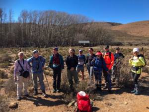
Hikers: Dennis Lange, Ed and Mimi Kay-Shuttleworth, Nelia and Stuart Neill, Gillian Forbes, Scott McIvor, Pierre and Som Kruse
These two peaks lie in the great Karoo near Nieu-Bethesda. Compassberg is an imposing mountain – the highest free-standing mountain in the Southern Hemisphere (and Eastern Cape). Murch Point is not a peak but just a highest point on one of the many hills, is the highest point in the Northern Cape. When I emailed Ed my meet proposal for Compassberg, he convinced me to add Murch Point. He and Dennis have hiked Compassberg before a few times. And he hiked Murch Point from the other side that we were to do it this time. So this route up Murch Point was a first for the MCSA. Extreme winter conditions happened in this area till just before the hike. Luckily, we experienced some of the warmest days of the freezing desert winter during the hikes.
We all met in Nieu-Bethesda and ate dinner at the Nieu-Karoo Country Restaurant. Saturday we departed at 8h00 to drive the long route to the starting point of Murch Point at Schanskraal farm. Lynette is the coordinator from the estate. 58km from Nieu-Bethesda, at the office/reception we filled in the indemnity forms (no entrance fee) and then drove the 7.84km tortuous gravel track to the trail head. Duncan, a farm manager guided us with his motorcycle to the starting point at the hiker’s hut. The hut can be a convenient overnight spot. It was too cold at night for us to consider it as an option. The whole drive took about 3 hours.
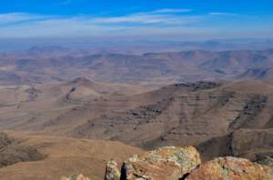
Very few people visit this area, so there weren’t clear paths to follow. We only had the GPS coordinate of the peak itself. We started off on a track climbing gradually. At a stage we crossed the fence at a large opening as per instructions. We then veered towards the left and gradually gained height on the right-hand side of the valley. The terrain reminded me of the Lesotho plateau – once one has completed a Drakensberg pass and started to traverse to the next one.
Ed and my GPSs acted funky, so it was difficult to determine the route. There are no landmarks to make things easier. We eventually determined where Murch Point is, and crossed over to the other side of the river to start scaling that part of the terrain. We reached Murch Point, and insignificant hill on the range around 14h00 , and ate lunch. The 360-degree views were superb and made up for the long slog to the top. We descended and arrived at the cars after about 14km and 5 hours hiking in total. We drove back and reached Nieu-Bethesda in the dark around 19h00. So all in all a very long day of driving and hiking. The very desolate terrain and desert scenery made it all worthwhile. One is stunned by seeing local people survive in such a harsh country.
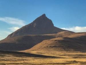
Compassberg
We departed at 7h00 for Compassberg after a cold night that reached -2C, as the previous one. After a long drive we reached the office where Brenda the farm owner received our R50 per person permit fees. We then drove another tortuous gravel track to the parking spot to arrive at the trail head at 9h00. Seven of us started the ascent from the northern side. Dennis, Scott and Gillian started off to climb the mountain from the wind-shadow south-eastern side. The climb is pretty and not too demanding.
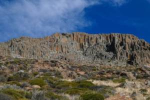
Compassberg cliffs
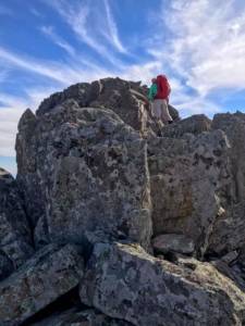
The top section has massive boulders and rocks to negotiate
A very strong wind gusted around the rim, so the women of our group, Nelia, Som and Mimi decided to stay on the edge . Ed, Stuart, Pierre and myself swerved to the left to complete the last section to the top from the east . We reached the top after about 2 hours. 2590m high – highest free-standing mountain in the Southern Hemisphere, according to the villagers.
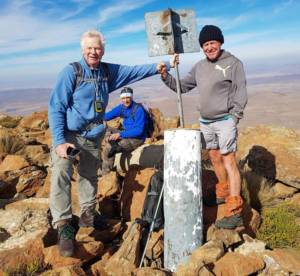
We were blown about by strong gusts of wind while the women were freezing on the rim about 200 meters below us. After lunch we descended and joined up with them. We reached the cars after about 1.5 hours hike down from the top – using the same route we climbed up with. 4.46km hiking in total.
Meanwhile the other 3 members of our group, Dennis, Scott and Gillian, were having a hair-raising experience climbing amongst huge boulders and deep gaps in the strong wind. They were all experienced, so eventually reached the top safely. They made a difficult but successful descent on the eastern side. We watched them descending and decided that some time in future we would also ascend from the south-eastern side.
Our scenic trip back was beautiful – slanting winter light over the gentle curves of the mountain ranges. We were in Nieu-Bethesda by around 16h00.
All in all two very satisfying climbs that are worth doing again.
Tips: start early in the morning for both hikes. The rugged rocky roads are demanding for SUV’s so drive slowly to avoid damage. All the roads take very long to cover.
Murch Point – stay on the left side of the valley after you crossed the fence. The instructions indicate otherwise. Then ascend gradually towards the peak. GPS is needed because the top is not visible until you reach it. According to Ed the route from the other side is more enjoyable. Problem is that the owner doesn’t give permission to start from his farm anymore.
Thanks to a very nice group for an enjoyable weekend!
Meet Leader ~ Corlius Jooste